UAV Mapping Service
Based on our experiences in the application of geospatial technology in the fields of ecology and conservation the Yorkshire Wildlife Trust is now offering a low-cost aerial mapping service for the collection of ultra high resolution aerial photographs and 3D topographic models.
Suitable for use in a range of GIS and remote sensing software we can provide up-to-date highly accurate surveys with a resolution far beyond that available with current stock aerial photography and digital elevation data.
With over 10 years experience within the geospatial sector our team can offer a range of products from data collection up to spatial analysis, habitat assessment, image classification and photo-realistic 3D visualisation.
All proceeds go directly back into nature conservation
Our data collection and analysis services include:
- Expertise in survey using small unmanned aerial vehicles
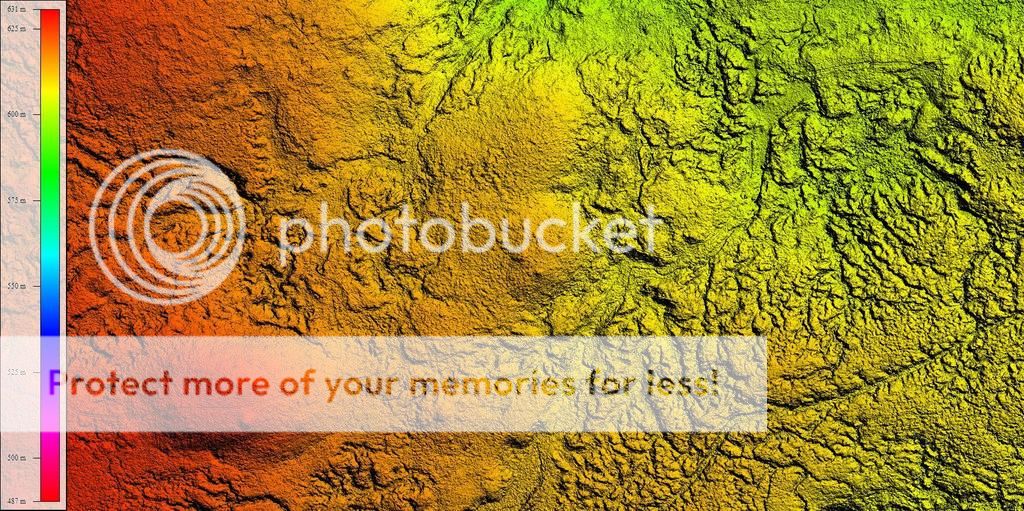
- Data processing for up to 1.5cm resolution aerial imagery and digital surface models
- A range of methodologies for habitat assessment
- Creation of photo-realistic 3D models
- Advanced 3D visualisations
- Fly-by animations
- Advanced 3D visualisations
- Automated feature extraction/mapping
- Virtual 3D models hosted online
- Plant health indicator using NIR sensors
- Animal counts for birds and seals
- Spatial analysis
- Conditional assessment of blanket bogs and remediation services
- Spatial analysis
- GIS advice and training (Desktop, Web mapping, Open Source)
As part of the Yorkshire Wildlife Trust we have a long standing reputation in ecology and conservation. By combining ecological excellence with geospatial innovation we can offer a range of solutions to your ecological monitoring, assessment and surveying needs.
Yorkshire Wildlife Trust
1 St Georges Place, York, YO24 1GN
Tel: 01904 659570
Email: info@ywt.org.uk
Yorkshire Wildlife Trust is registered in England no. 409650 and is a registered charity no. 210807
Civil Aviation Authority Approved And Licensed. UK CAA Approval No: DAI/9932/09
Love Yorkshire, Love Wildlife
www.ywt.org.uk